The Measurement Paradox Behind Earth’s Greatest Peaks
Depending on which scientific baseline you choose, three different mountains lay claim to the world title:
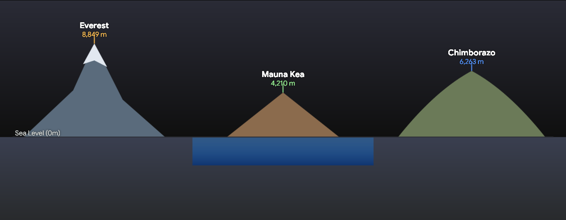
| Measurement Metric | Winning Mountain | Location | Official Scale |
| Highest Above Sea Level | Mount Everest | Nepal / China border | 29,031.7 ft (8,848.86 m) |
| Tallest Base-to-Peak | Mauna Kea | Hawaii, USA | 33,500 ft (10,210 m) total |
| Farthest from Earth’s Center | Mount Chimborazo | Ecuador | 20,903 ft (6,263 m) above sea level |
Mount Everest: Highest Altitude Above Sea Level
Mount Everest holds the universally recognized record for the highest altitude above mean sea level. Located in the Mahalangur Himal sub-range of the Himalayas, its summit sits in the upper troposphere, where air density drops to roughly one-third of sea-level pressure.
- Tectonic Lift: Everest is not static. Driven by the continuous collision between the Indian and Eurasian tectonic plates, the Himalayan range rises by approximately 0.16 inches (4 mm) every year.
- The 2020 Measurement Consensus: Following decades of minor discrepancy between Nepal (measuring snow height) and China (measuring rock height), both nations jointly declared the official refined elevation at 8,848.86 meters in December 2020.
Mauna Kea: The True Base-to-Peak Giant
If you define “tallest” as a mountain’s total physical structure from its submerged geological foot to its peak, Mauna Kea easily surpasses Mount Everest by more than 4,000 feet.
Mauna Kea is a dormant shield volcano whose roots rest on the Pacific ocean floor.
- Submerged Mass: Roughly 19,700 feet (6,000 meters) of Mauna Kea’s continuous slope sits under water.
- Visible Peak: Only 13,796 feet (4,207 meters) rises above sea level.
- Total Height: Measuring the full structure from its oceanic abyssal base to its summit yields a staggering total height of roughly 33,500 feet (10,210 meters).
Mount Chimborazo: The Equatorial Bulge Effect
A lesser-known geographical anomaly places Ecuador’s Mount Chimborazo closer to space than any other terrestrial surface point.
Because Earth is an oblate spheroid rather than a perfect sphere, the planet bulges outward around the equator due to centrifugal force generated by its planetary rotation.
Sitting just one degree south of the equator, Chimborazo benefits heavily from this planetary bulge. Even though its sea-level altitude is 20,903 feet (6,263 meters)—substantially lower than Everest—its summit sits approximately 6,800 feet (2,072 meters) farther away from Earth’s center than the tip of Mount Everest.
Geographical Archives & Survey References
- National Geographic Society: Himalayan Tectonic Survey and Elevation Mapping
- USGS Hawaiian Volcano Observatory: Mauna Kea Topographic and Bathymetric Records
- Institut de Recherche pour le Développement (France) / IG-EPN (Ecuador): Chimborazo Geodetic Mission